 The Outdoor Adventure Giving you tips, tricks & recommendations to help make adventuring in the Outdoors fun, safe & exciting for you and your kids.
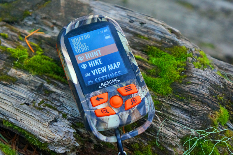

A full colour GPS with topo, shaded relief or satellite image overlay and it fits in the palm of your hand. I’d say that’s pretty cool… but wait, it does more? Queue the music…
The Magellan eXplorist 350H was built for hunters and hikers. Aside from those cool features I just mentioned, it has a number of others that cater to more than just the geocachers amongst us. If you want to see a summary of what it does, check out the video below and keep reading for more functionality and my thoughts on whether it hits the target or not.
Disclosure: Magellan sent me this device for review, so as usual I do my best to test things thoroughly and as always, the opinions are my own, honest and what I’d recommend to family and friends.
Features:
Physical Features:
- Display: 2.2” diagonal
- Resolution: 240×320
- Weight: 5.2 oz
- Dimensions: 5.8 x 2.4 x 5.7 inches
- Batteries: 2 AA (configurable for type)
- Waterproof
- Mini USB port
- 5-way joystick
- On/off button
- Zoom in/out buttons
- Menu and back buttons
- Webbing loop
- Camo/hunting orange colours
Key Software Features:
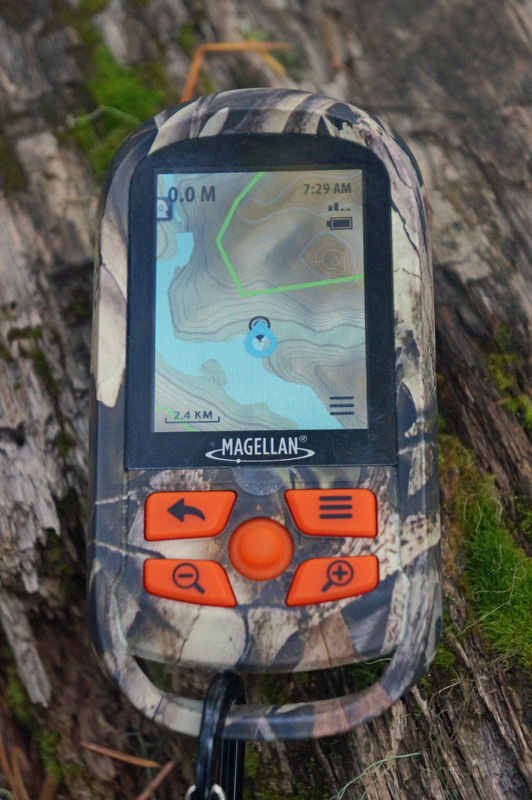
- Topographic, Shaded overlay and downloadable Satellite image overlay (down to 2 feet per pixel)
- 1 year free subscription to digital globe (satellite overlay maps uploadable to your GPS)
- Hunt and Hike modes
- Customizable waypoint markers
- Preloaded with Game Management Unit borders (for hunters)
- Programmable alarms notify when you enter or leave a hunting zone
- Navigate back to start
- Waypoint field notes
- Accompanying desktop software for planning and managing trips
- Dashboard view for showing:
- Distance travelled
- Elevation change
- Elapsed Time
- Average Speed
- Digital Compass
- Hybrid map/compass view
- MSRP: $250 – on sale for $180 at amazon here (affiliate link)
Testing:
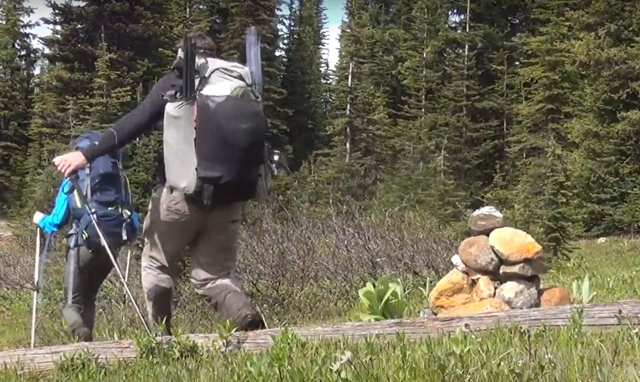
I tested this device over the course of a year in cold, warm and wet weather in the Pacific Northwest. It has been tested in torrential rain, full sun and of course sub-zero weather (isn’t it always cold in Canada?).
What do we think?
Physical Features:
Magellan has done a great job at packing all these features into a small device. It’s at the point where half the device is the battery compartment. It really does fit in your hand. The display is small at 2.2: on the diagonal, but because of its resolution, clarity of fonts and brightness, that average sized screen looks ample.
With two AA batteries, the device supposedly lasts for 18 hours. I’ve found that with a set of Lithiums I’ve gone through 2 3-day backpacking trips without having to change them out. After that I changed them only to make sure I didn’t run out on my third trip.
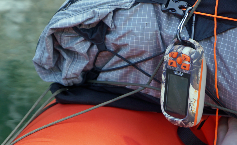
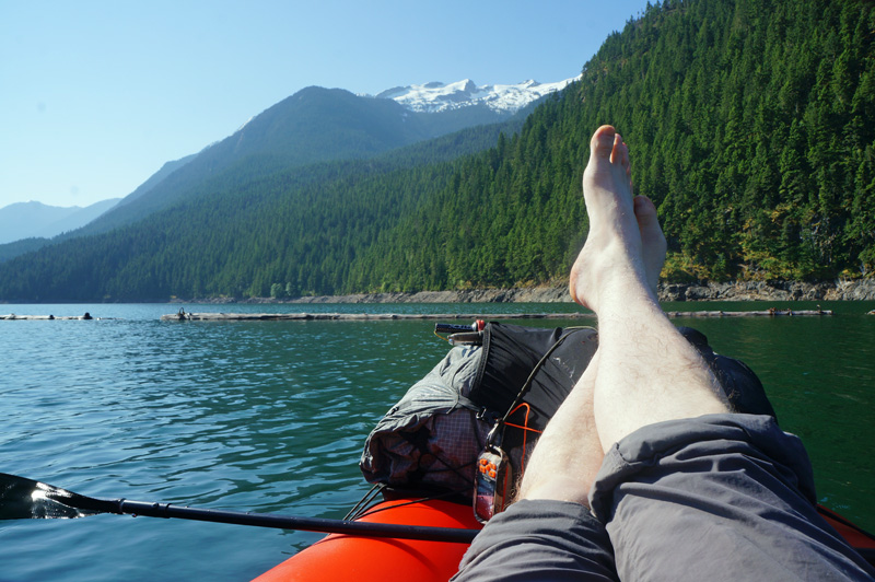
Knowing its waterproof is comforting for someone who likes to get out and packraft when he can. The only challenge is that it makes the battery compartment a bit difficult to open and close. A small price to pay for a robust device.
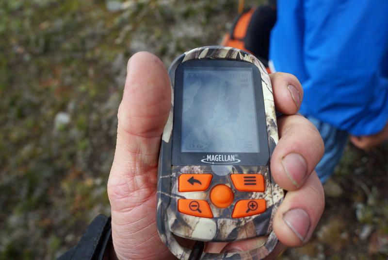
I was happily surprised to find that the mini 5-way joystick was quite easy to use, even with gloves on. I suspected challenges on the down press, but have never found myself fumbling with the device. That said, typing a field log could get tedious. That’s where the wide array of waypoint icons comes in handy. A picture saves you from typing a thousand words.
One more thing about the buttons. It took me a bit of time to find the off/on button. It was too well camouflaged. Also, it’s flush mounted making it extremely unlikely that you’ll accidentally turn it on or off.
The webbing loop is exactly that. For webbing only. It’s too small for most carabiners, so a short length of paracord makes a handy attachment point.
Software and Interface:
This device is designed for hikers and hunters. It’s for people that go on trips. As such, waypoints are tied to the trip you’re on or that you’ve planned. Some find that frustrating if they just want to randomly tag a waypoint without tracking their trip, but for me it makes a lot of sense for what I do.
The wide array of waypoint icons would come in really handy for detailed trip planning and documentation, especially for hunters. No need to flag with tape and forget what was so important about that spot. For backpackers on long trips documenting those ever necessary water sources, stealth campsites, reliable fishing holes, or berry bushes will mean you won’t waste time looking on your next time through.
I’m a huge fan of the shaded relief maps and satellite overlay. I didn’t grow up reading topo maps, and while I can, the shaded maps make it immediately obvious what terrain to expect and what to watch out for. The fact that it’s full colour is another boon. Even better are the satellite overlays. I like to venture into areas where there is no trail, so often topography isn’t enough. Being able to turn on a satellite overlay and know how dense the trees are, where the meadows will be and even if there are streams, creeks or structures is an extra plus.
In Canada, I choose trails that can bring me back and forth between park boundaries and crown land (read Game Management Units). In parks there are often laws about collecting firewood, collecting mushrooms or having fires. On a trip last year I was able to track my location and make sure I kept within the law. It was nice to see that a feature I didn’t think I’d use (I haven’t ever had a hunting license) could come in so handy. Oh and you can set alarms to notify you when you enter or leave those areas.
There are more hunting features such as the ability to program sunset and sunrise to make sure you’re not hunting outside the legal times, as well as tracking the phases of the moon for ideal hunt times, features that could come in handy to the experienced (or inexperienced) hunter.
I could go on and on about the dozens of other features of the eXplorist 350H, but as they are common to most modern GPS units (navigate to start, navigate to waypoint, elevation, elevation change, speed, distance, compass, alternative mapsets, but I think we’ve hit the important features.
In Conclusion:
If I were to make improvements, I’d like to see a bigger loop to hook a carabiner on as well as the ability to enter waypoints outside of a trip.
The absence of those features are not deal breakers. In fact, it’s hard to beat the number of features that this device does have for the price.
At a time when the market is flooded with GPS units and everyone wants a slice of the GPS market pie, Magellan has come out with a device that brings something unique to the table. If you’re a hunter who like to hike, or a hiker that likes to hunt, or just someone who wants something extra for his GPS unit, check out the eXplorist 350H.