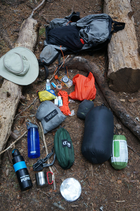
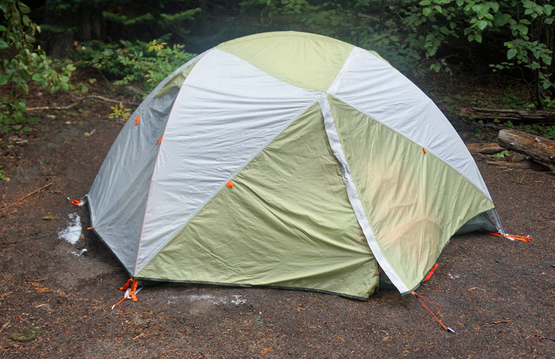
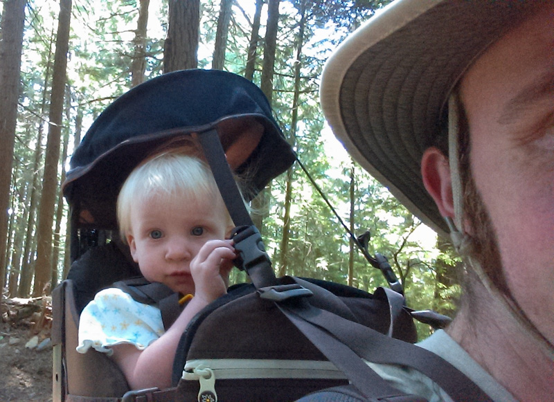
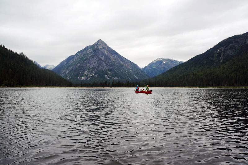
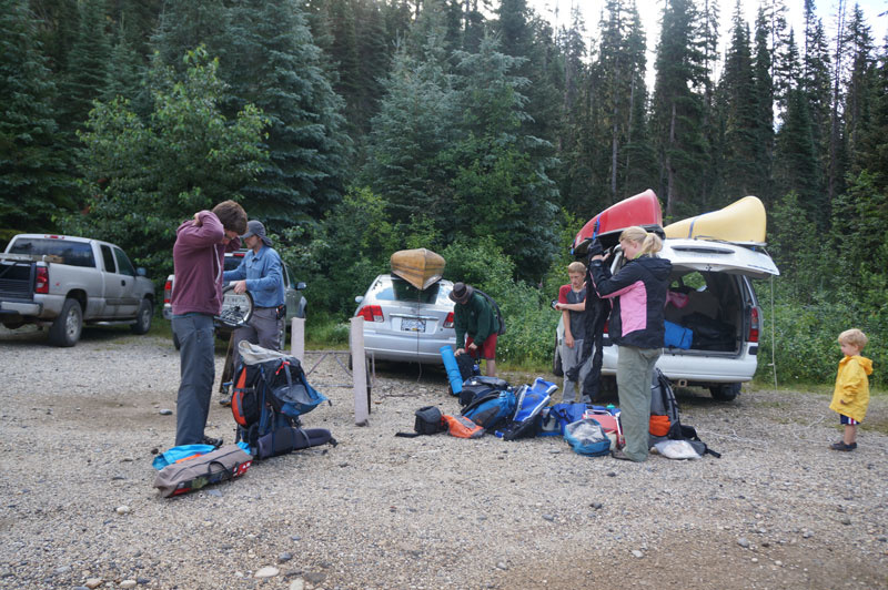
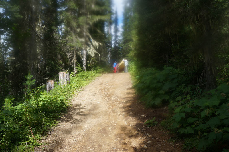
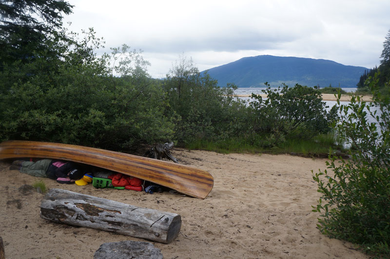
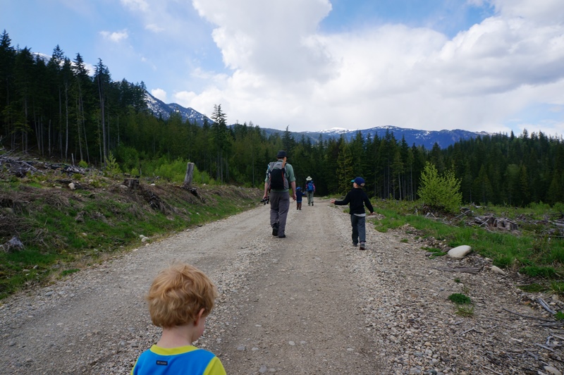
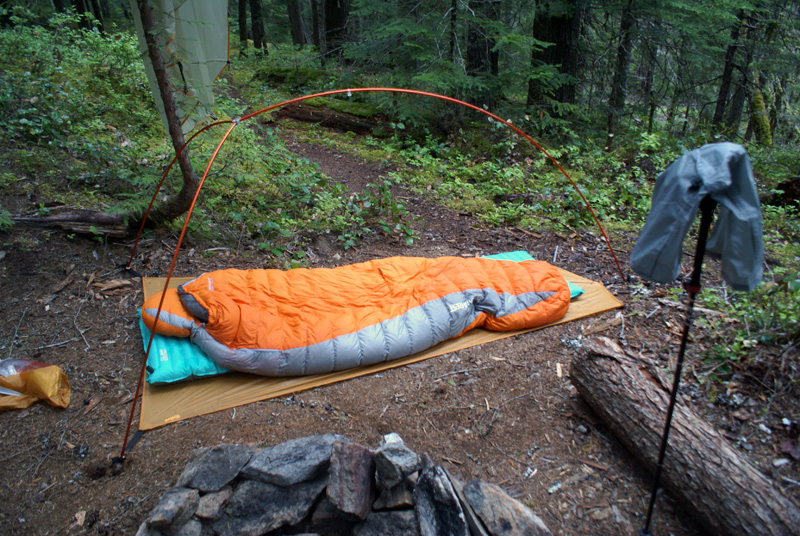
In Early summer my brother-in-law and I returned to Ross Lake (the location for our backpacking packrafting trip). This time it was a fun overnight hammock hang. This is day 2 – with a bit of gear lists and our trip out.
In Early summer my brother-in-law and I returned to Ross Lake (the location for our backpacking packrafting trip). This time it was a fun overnight hammock hang.
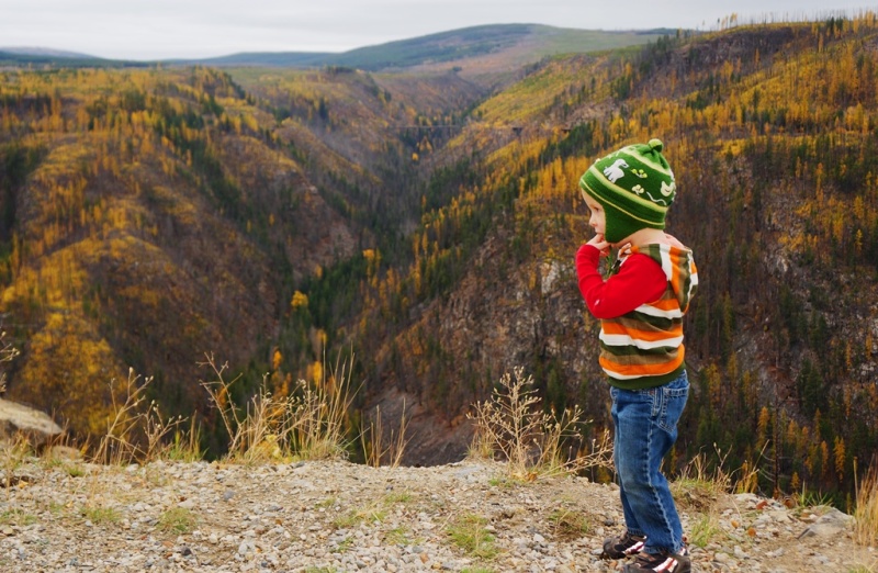
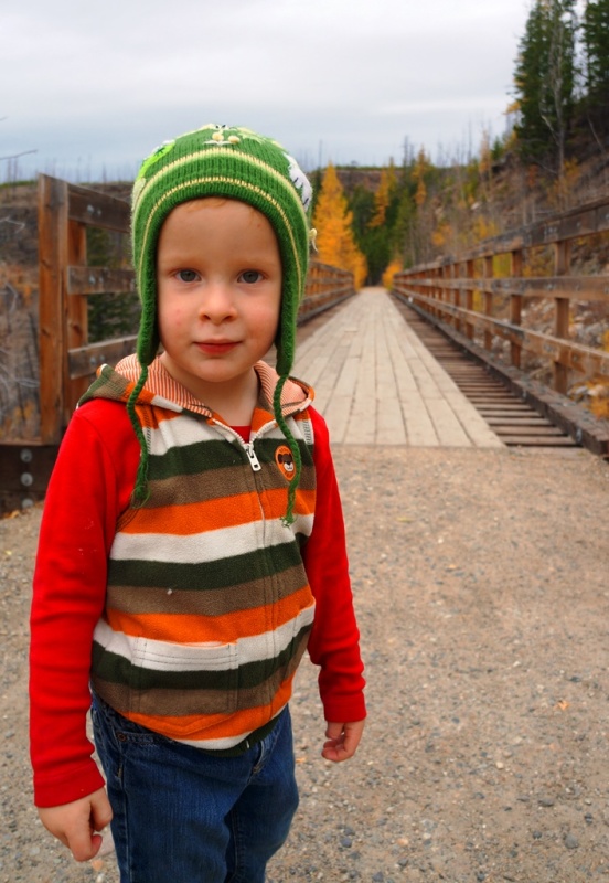
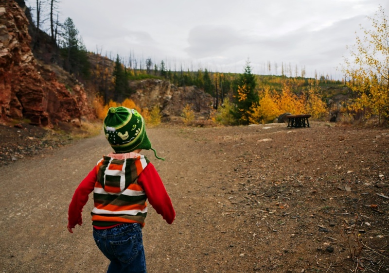
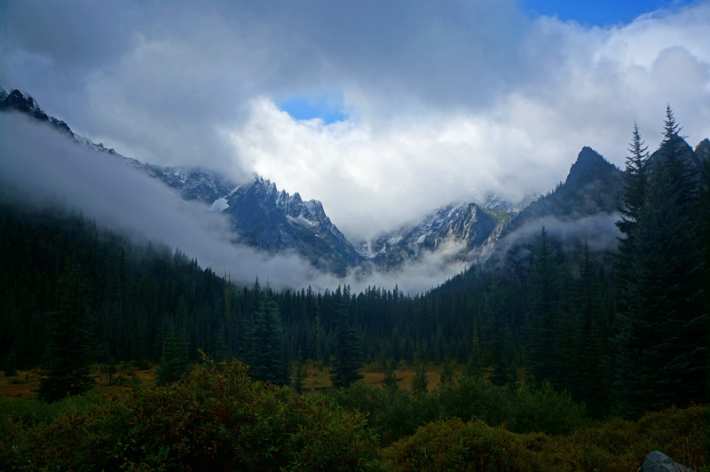
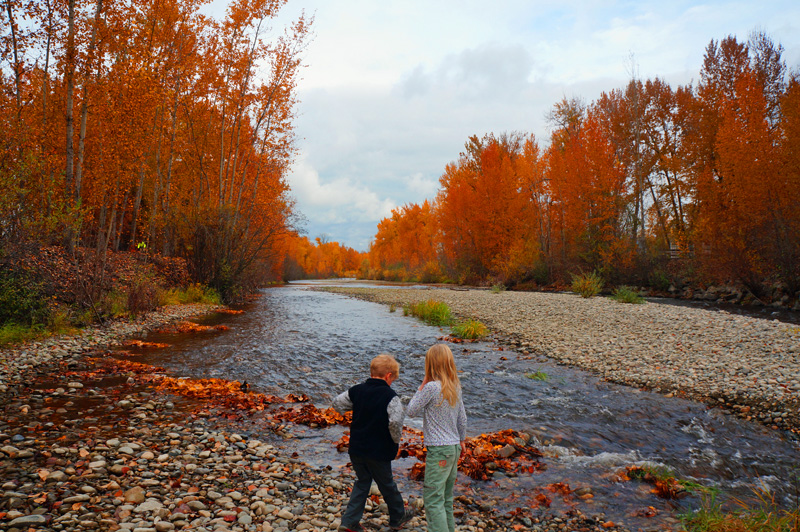
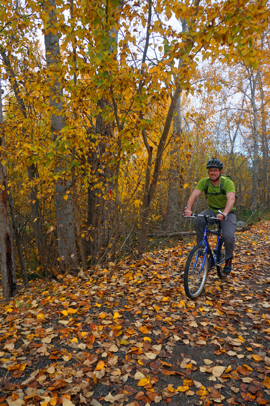
The Kettle Valley Rail Trail was a Railway line founded in 1915 by the CPR that snaked its way around the Kettle Valley and that formed part of the Transcontinental railway that made its way through the Rocky Mountains.
Abandoned in 1961, this section of the route was converted into a multi-use walking and cycling trail.
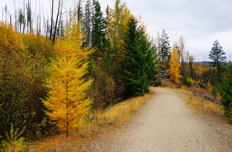
Its many rail bridges and beautiful fall colours make it an ideal destination if you’re in the Okanagan Valley.
Click to see the full sized image
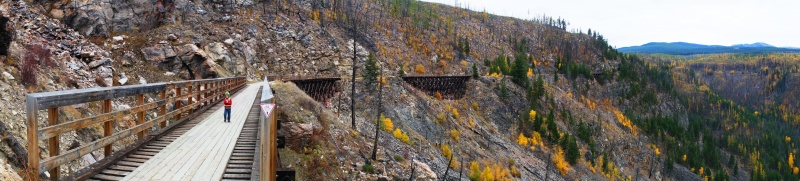
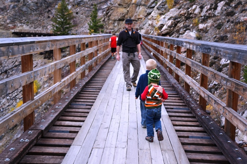
The most common section is a 12 km route from Myra Canyon Station to Ruth Station. (see Map). It offers a flat trail (designed for steam engines) with 18 bridges and two tunnels.
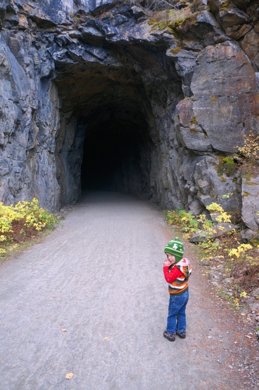
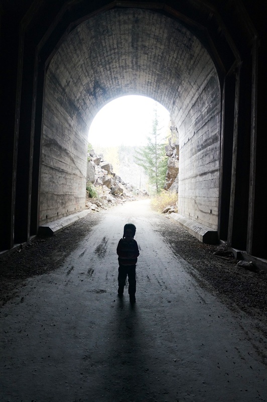
The Tunnels, blasted out of the rock face are amazing, and a blast for kids (and the young of heart).
Dispite the intimidation of the tunnels, there’s plenty of room and plenty of light. Make sure to test the echoes as you trot through!
Due to forest fires, 12 of the bridges have been replaced in the past 15 years with near identical replicas. They’re very family friendly.
A big draw in the fall is the fall colours. The larches set the landscape on fire and offer a beautiful contrast to the green pines.
Fall is the perfect time to ride a bike or take a stroll with the kids down the “KVR” so get out there!
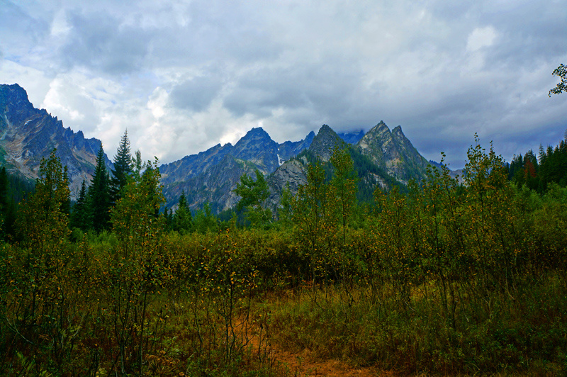
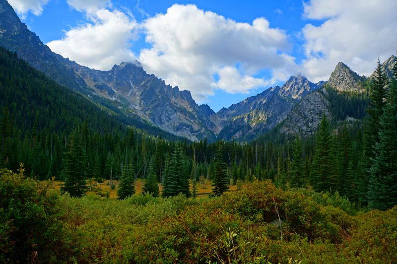
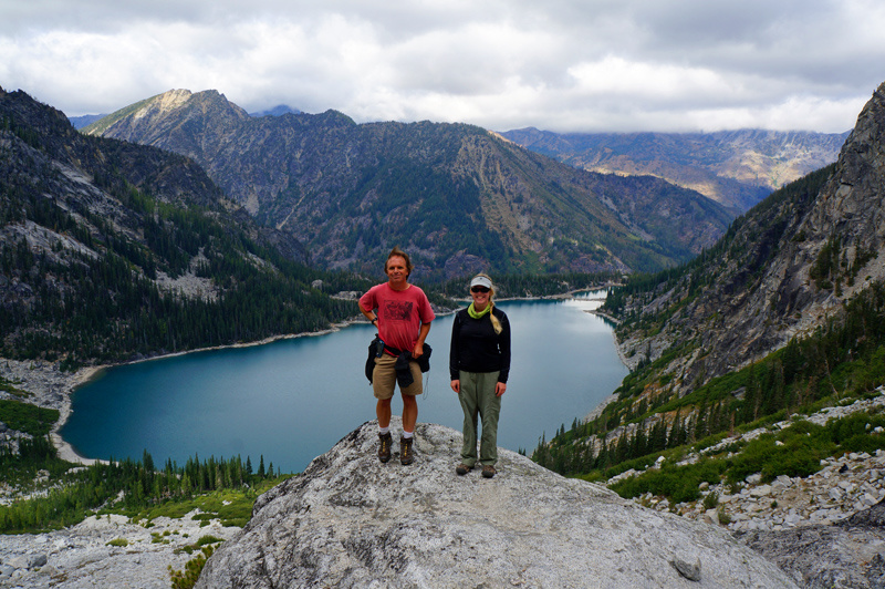
In early September, Mrs. Adventure joined a group of our friends on a trip up to the Enchantments in Washington. They headed up to Lake Stewart and up to Asgard Pass. Here’s her trip in photos.
“I can see why it’s called the Enchantments. The peaks look like a child drew them; all fairy tale jags and triangles.”
“The first night was cold, but the second night wore a warm blanket of cloud cover. The trade-off? It rained and rained and rained. The next morning we woke up to realize that we had slept not only warmly, but also extra-comfortably. We had a water-bed. The entire tent was submerged in an inch or two of water, but because of some smart people at Kelty, we were perfectly dry inside.”
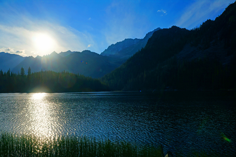
“My personal highlight was climbing Aasgard Pass from Stuart Lake. See that low point in the mountains in the distance? That’s the pass. We climbed that.”
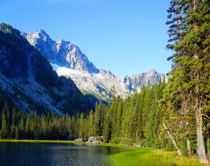
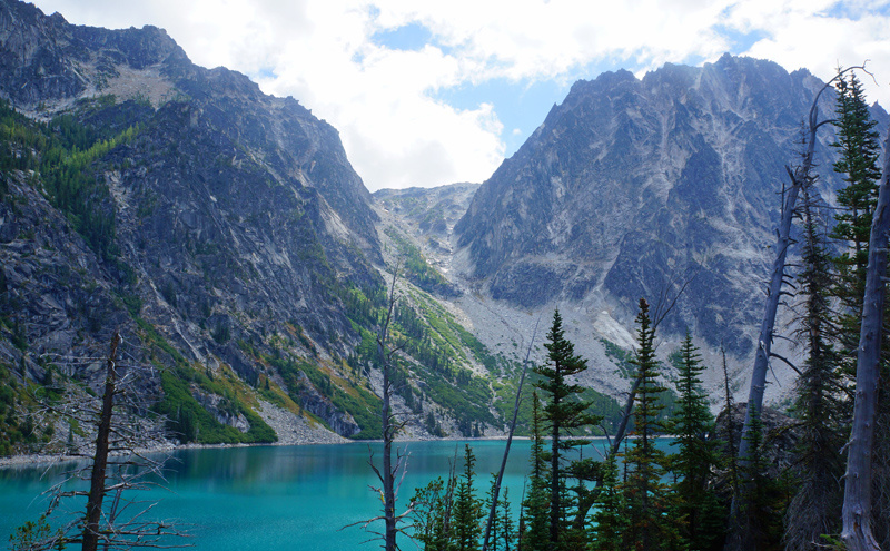
“We hiked from the peaceful Suart Lake to Colchuck Lake, which while a picture-perfect glacier lake with unexpected white-sand beaches, it was teeming with people, not unlike some sort of pina colada resort.”
“The lake has more permits than Stuart and is a popular entry-way into the Core Enchantments area.”
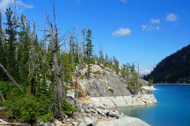
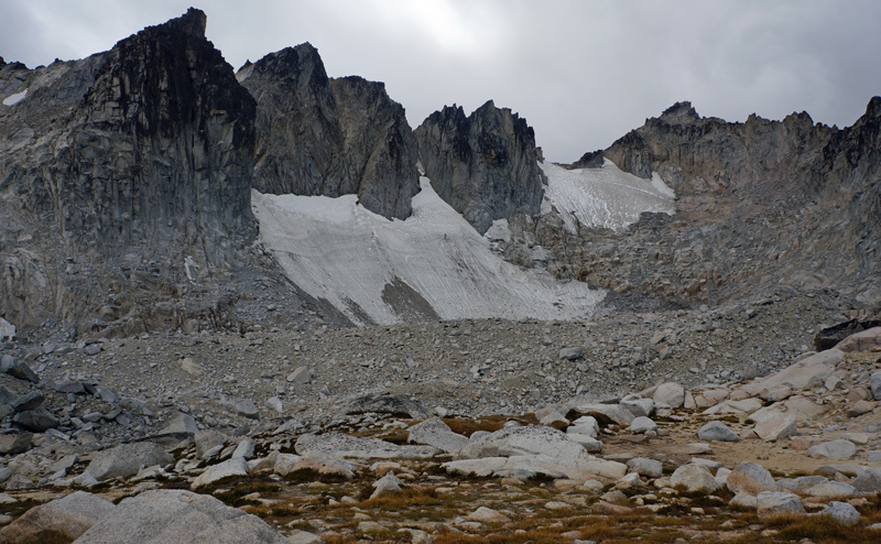
“A couple of us decided to continue up the pass. It was difficult to take photos from the very top, but about halfway up we stopped at a convenient rocky outcrop. Nearer the top, the lake was like a grape-sized opal shimmering at the throat of the valley. Photos never seem to quite capture the scale or grandeur of reality, though, do they? Part of the hike around the lake is a fun scramble over boulders. It would be a real challenge with a heavy pack or in the dark!”
“We didn’t spend much time at the top. It was freezing cold. I couldn’t feel my fingers after a while and we could hardly talk through our chattering teeth. My hiking partner had been up through the Enchantments several times before, but this was the first time it had been this cold. We were also nervous that we would not make it back in time before nightfall (we did, thankfully) and we would run out of water. I was very glad for the down jacket, weatherproof jacket, and warm merino sweater I had brought, but mental note for next time? Also bring gloves, a water filter, and a headlamp. I was feeling a bit sorry for the people camped out up there. We had entered the Core permit lottery the previous morning and had not won, but at that moment, standing there at the top with the wind slicing through me, I knew I hadn’t packed enough keep off this kind of cold at night. I was glad we were camped at the lower-elevation Suart Lake!”
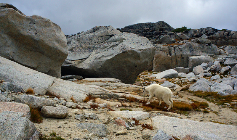
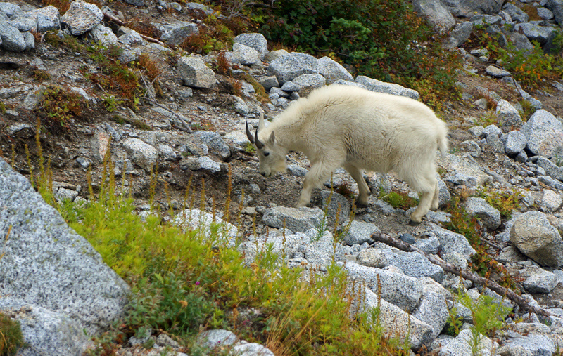
The goats are super friendly…
“There’s a reason why the Enchantments area is popular. It really has it all. Camping at Suart Lake made it more tranquil and peaceful and less strenuous than if we had hiked through the Core area or camped at Colchuck. The hikes in from the Stuart Lake Trailhead to Stuart Lake and from Stuart Lake to Colchuck Lake are easy if you take it slow, as there is a substantial elevation gain. The haul up to the pass is a rewarding challenge, with mountain goats at the top to celebrate with!”
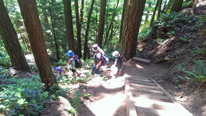
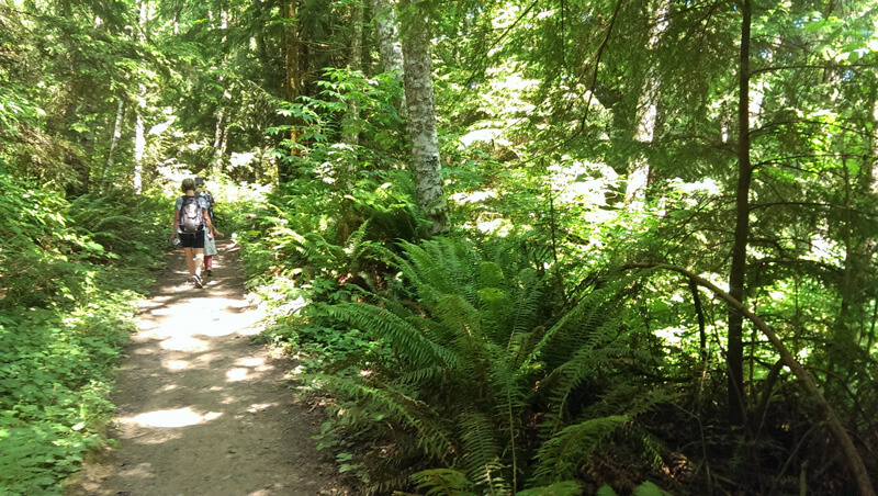
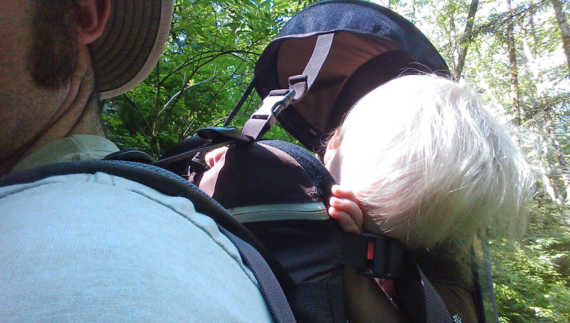
On June 20th, my wife, our 3 kids, and my mother took a stroll down the Rock Trail in Larabee State Park just south of Bellingham, It was a great hike with some beautiful photos. The whole hike was about 2.4 miles round trip with 1200ft of elevation change. With kids and breaks it took us about 3 hours. There are a lot of stairs near the beginning but they are well maintained, easily manageable for most ages and well worth the sights along the trail.
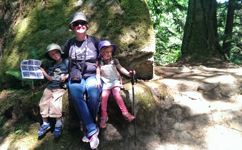
My wife and 2 older children were given this hike to do as part of a program called “Trek for Treasure” sponsored by the local hospital. Their mission was to use some pictures to find a treasure box with a clue to solve later.
Taking a left to the Rock trail. The trail to the right is used by mountain bikes to head down the trail.
The first part of the trail includes a lot of stairs. They are well constructed and easy to manage.
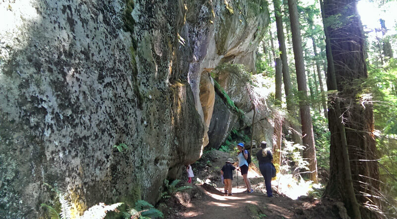
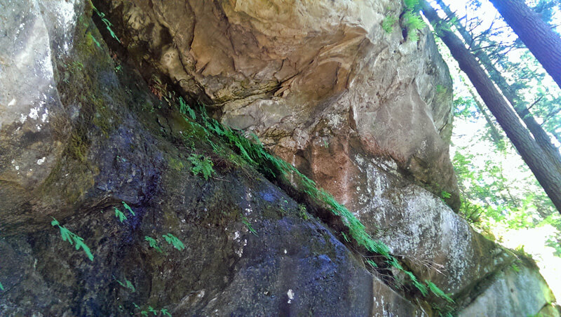
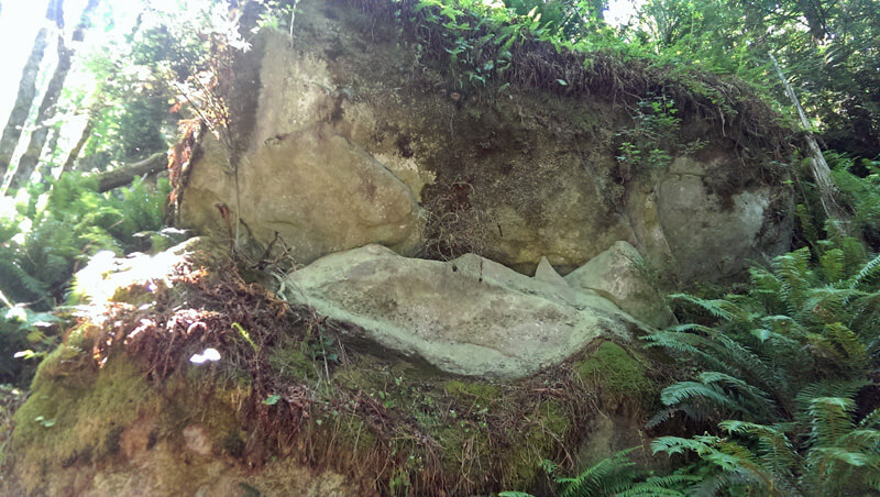
When we reached the bottom of stairs, we shortly come to a magnificent cliff.
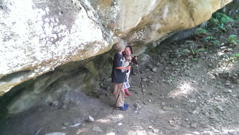
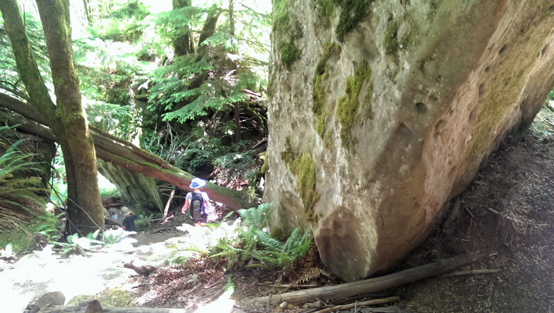
A couple of junior adventurers stand at the base of this great rock tower.
Water seeps out of the rocky seam, providing moisture for a few ferns.
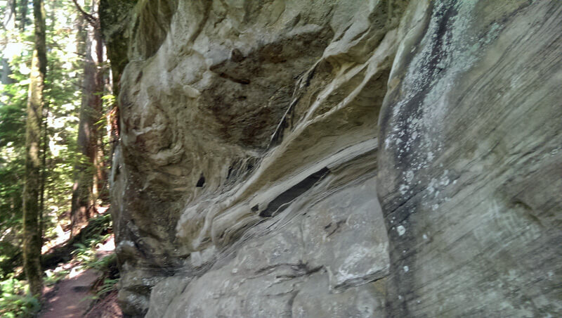
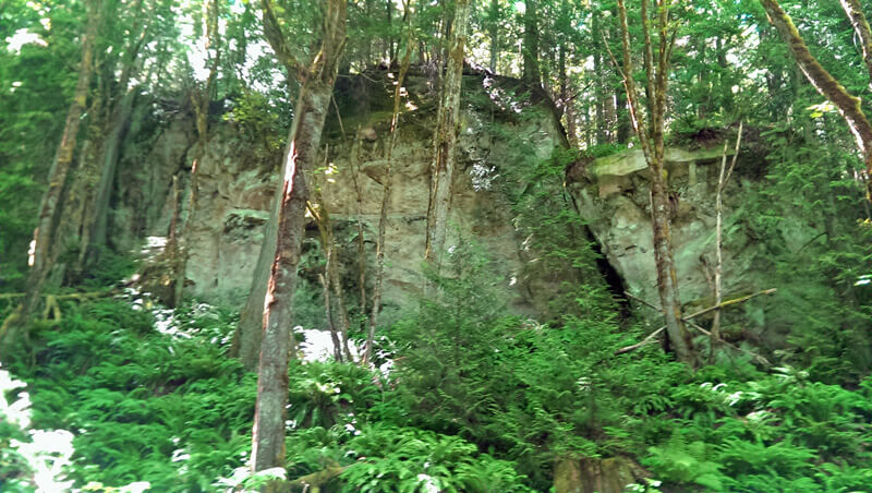
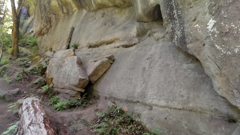
As we continued down the trail, we came to cliff that looks like sandstone. In an area of the world known for granite, it was very cool to see these formations towering above us.
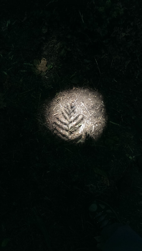
We continue heading down, stopping to see the sights. As we rounded the corner we came across the following shadow on the ground.
The contrast is incredible. As I was looking at this, I couldn’t help but think of the New Zealand All Blacks
The trees provided shade for what was otherwise a fairly warm day.
Here we sit on one of the many rocks, check the treasure map and get ready to continue on.
Stunning towers of rocks provide background to the trees.
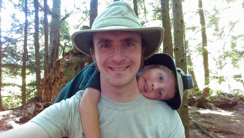
On one of our breaks, I had to take a selfie with my son. I had a backpack on with our youngest adventure, so I was no stranger at this point to have a child on my back.
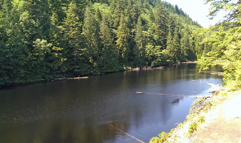
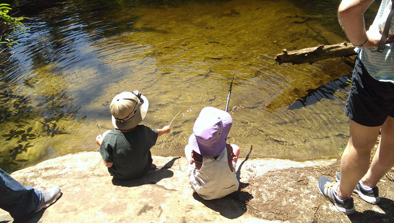
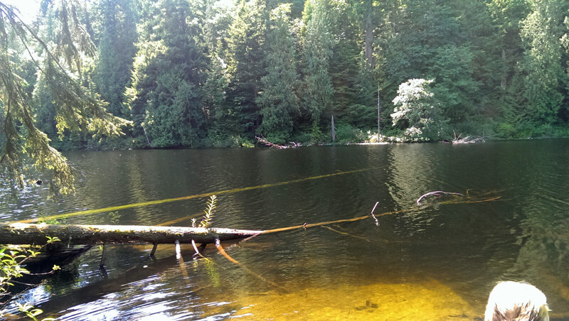
Having walked among the rocks, we came out from the trees to take a stroll by this lake.
As with any lake, it is important to do a bit of “fishing”.
Honestly … I kind of wish I had brought a fishing rod as it would have been a great way to pass the time even if the fish are all in deeper water.
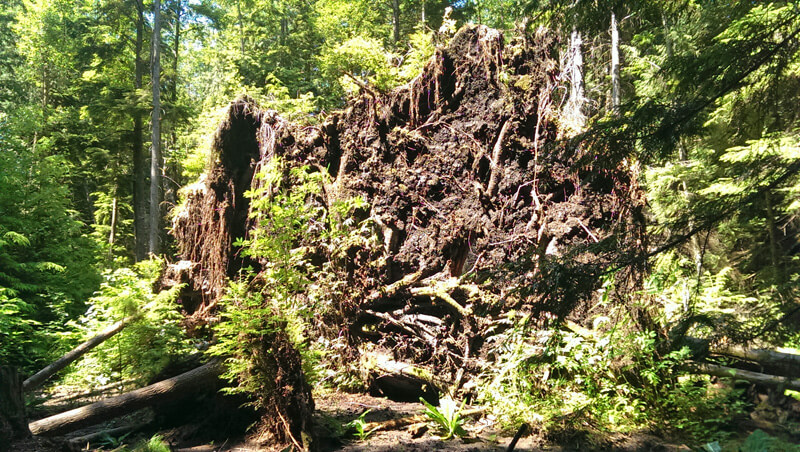
We stopped at the lake for about 30 minutes where we found the required treasure chest and clue that the Mother and children adventures needed. Heading back the way we came we stopped to look at the roots of this fallen tree.
All this hiking made the littlest adventurer tired!
The other direction give a fresh perspective to the rocks. We stopped to enjoy the plants growing on all the rocks.
As expected, what goes down must come up. With gravity working against us, it was significantly more challenging going back up. However, the quality of the stairs meant that progress was steady. In no time we had returned to the top.
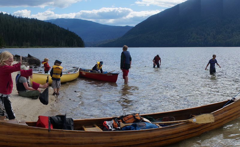
Murtle Lake is North America’s largest kayak-and-canoe-only lake. I like that. It’s quieter. It’s safer. It’s cleaner. It’s a little brag-worthy. 🙂
It’s more than that.
Canoeing is to me like slipping into a sanctuary; in pushing off from the shore I can almost feel all the cares and worries wash off my face and drop into perspective below in the deep water.
Life is simplified. Meditation feels easy. Hard work is good. Food tastes better.
We were a bit nervous at first about this trip, though.
After all, the ratio was 2 adults, 3 teenagers, and 4 kids.
There were three canoes, three tents, three nights, three hot dinners to make, three duffle bags jammed full of food and kitchen items alone, and three teenagers with trusting parents waiting for them at home.
It’s all going to be worth it…
Just one portage and then it’s plain sailing paddling!
It’s just 2.5 KM…
We had paddled just 1.6 KM the first day when we pulled off to the first group site; a storm had billowed up and the lake was choppy. None of us had slept more than 3 hours the previous night, so we just cuddled up and pretended we were Voyageurs under our canoes for the afternoon.
Hunkered down under the canoes.
The next day was still peeping around clouds and sighing wind over the waves, but we went 20.5 KM that day.
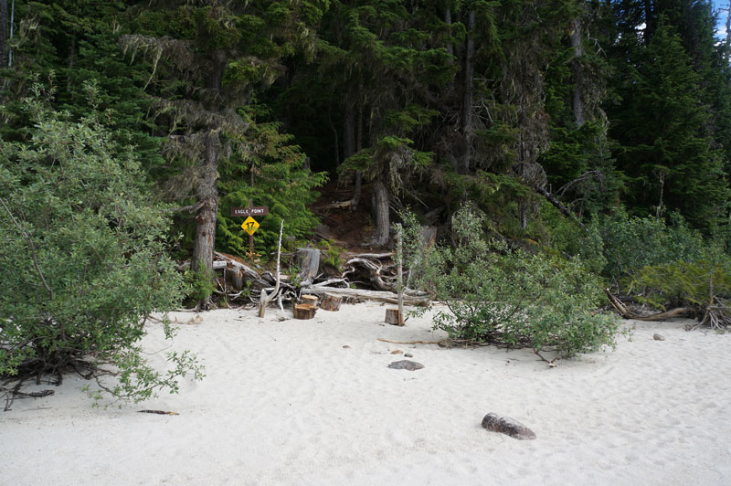
Eagle Point beach.
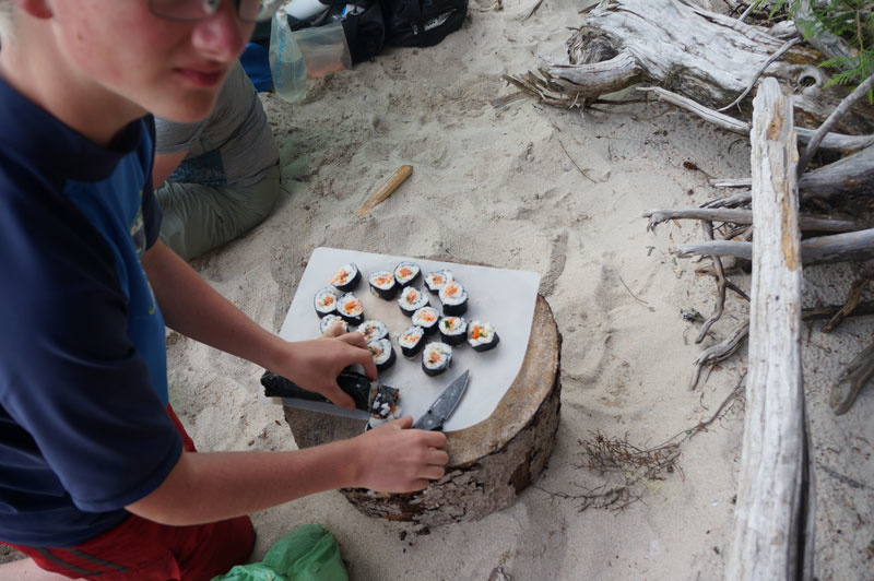
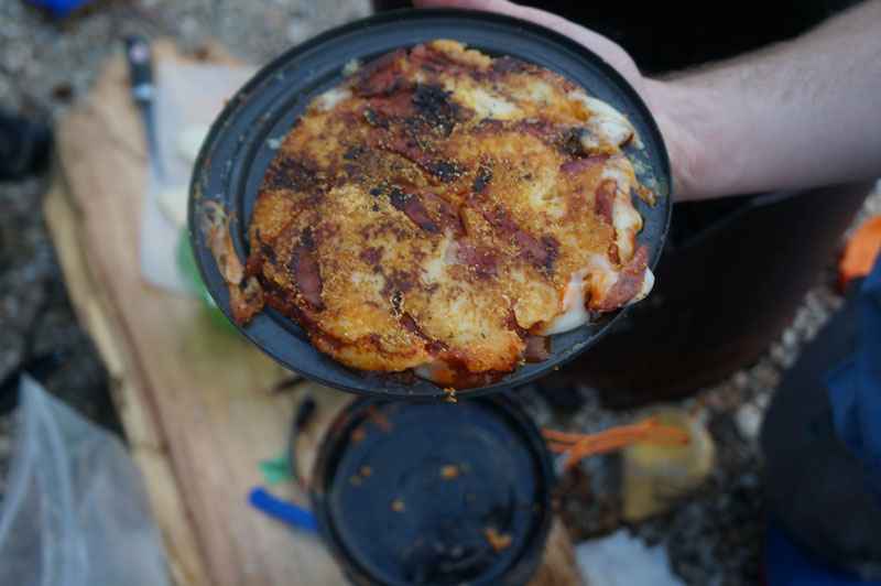
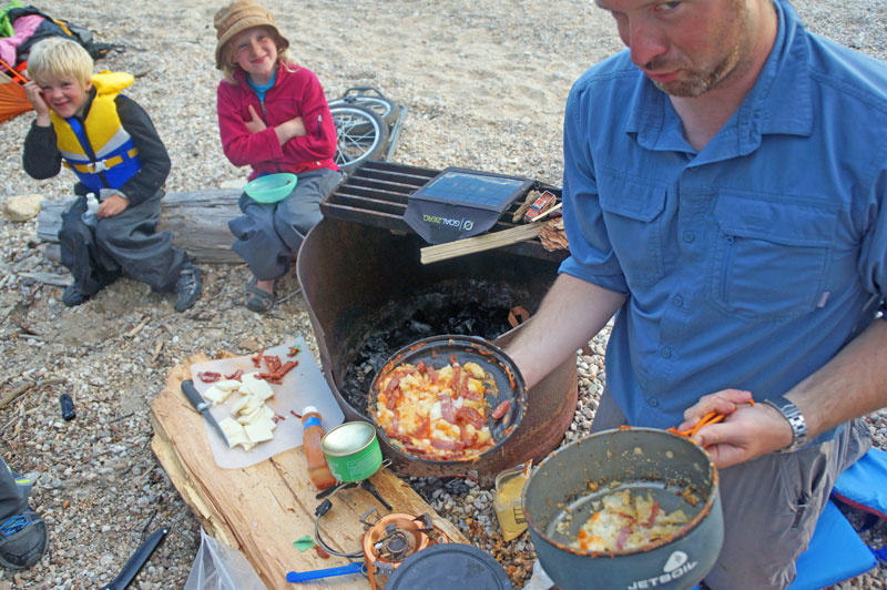
Fresh fried fish and sushi for dinner! And then, for those bold enough to venture not just from city’s shelter, but from the cozy warmth of a well-earned sleeping bag (not me), an endlessly starry sky to feast upon (apparently).
Mmm, fresh trout sushi.
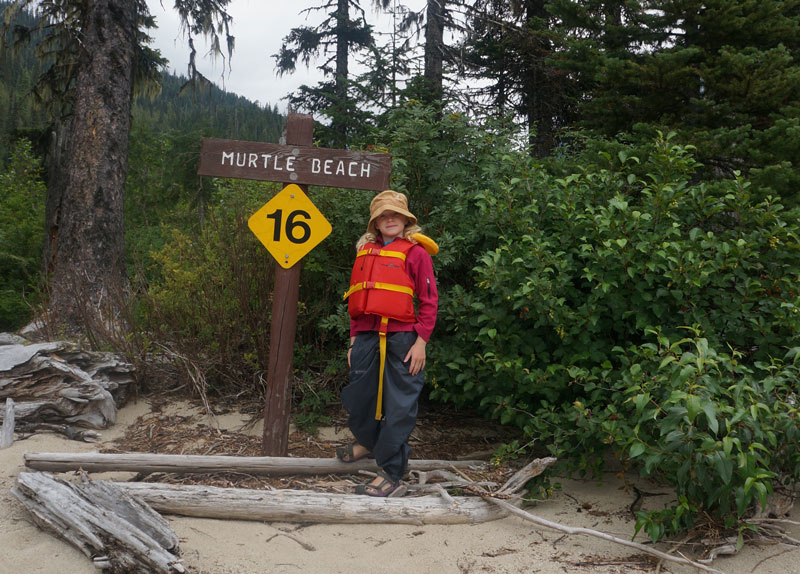
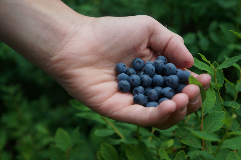
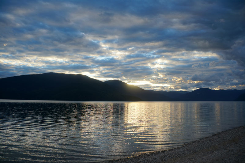
Saturday bloomed beautifully over the glassy mirror of the lake. At the north end of the lake, Murtle Beach, an earnest committee of hungry mosquitoes welcomed us as we celebrated our trip’s halfway point.
While the mozzies snacked on us, we snacked on handfuls of these little wilderness candies:
Wild blueberries, yum!
After paddling 23 KM, we made it back to the south end of the lake. Pizza night!
Sunday was a leisurely 8 KM back to the launching site, the three food bags emptied, three garbage bags filled, and all the kids accounted for.
While not as carefree as it would have been had we traipsed the lake alone, every ache in my arms felt good, even after all the laundry was done.
Thank you to my kids, especially the oldest, who can now paddle with Daddy in her own canoe. Well done!
Thank you to my other three for enjoying the ride and eating an impressive amount of candy and berries.
Thank you to G, M, and N for joining our family and willingly pulling their own weight at the paddle, portage, tent pitching, and pots and pans!
M – thank you for a perfectly spiced, perfectly crisped trout treat!
G – that portage out was really something. Thank you.
N – Thanks for all the quiet quips! (And for not losing your toe.)
Thank you, too, to the Murtle Lake Park Operators! The campsites are beautifully appointed and idyllically rustic, and the speedboat regularly coming by was a peace of mind for this mama!
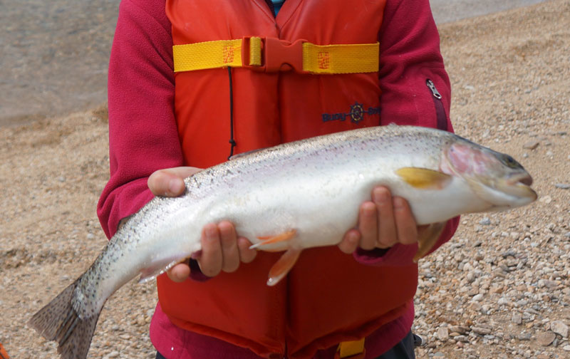
Thank you for oohing and aahing over our daughter’s catch!
OOooo I can’t wait to show my granddad this!
Our route and camping sites.
Our route and campsites: Night 1: Site 2 Murtle Lagoon South. Plenty of sites. Night 2: Site 17, Eagle Point. Beautiful beach. Great fishing! Night 3: Site 20, Strait Creek. Pretty crowded.
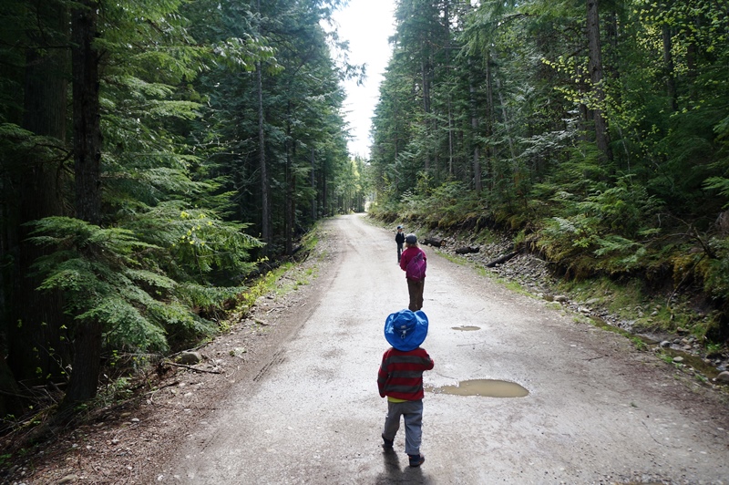
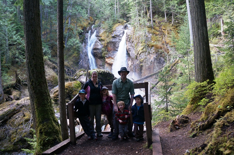
Just five minutes south of Revelstoke, BC we found an awesome day hike that took us through temperate rainforest to multiple waterfalls and even a beach. We had an awesome, adventure filled family hike and we’ll definitely be going back.
The Begbie Falls area is at the end of a logging road that offers many side trails for mountain bikers, hikers and climbers, but the real highlight for us was the falls.
There are two parking lots. The first is about 2.3 km from the actual Recreation site and the other is about 50 yards from the upper falls. We chose the farther parking area and hiked down the logging road with the kids.
There was plenty of exploration and discovery and we were treated with some amazing views of the snow covered peaks.
The falls themselves were flowing strongly with the spring run-off, but the trails were surprisingly mud-free. The kids were running around looking for sticks and laughing in the roar of the river.
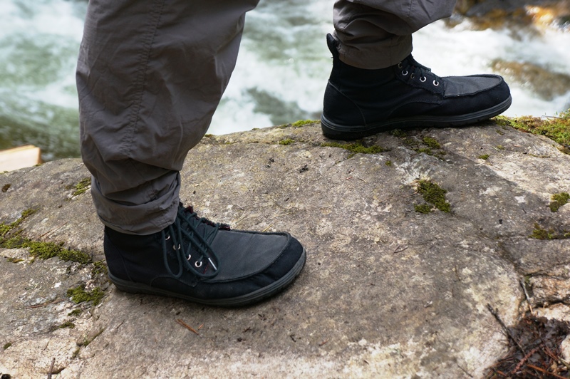
The older kids got a turn on the camera. I guess they have seen me do too many gear reviews. These are Lem’s minimalist Boulder Hiking Boots.
The lower falls trail led us zig-zagging down the hillside and just about to the level of the main river that leads into Upper Arrow Lakes. There’s a safe lookout which seemed like a good photo op.
From there we headed out to the sandbar on the river. We encountered a few campers on the beach, but managed to find a private area for the kids. Lunch was spent with more splashing, exploration and obligatory races with the kids.
We can’t wait to go back again in the summer when the wild flowers and wild berries are in full bloom.
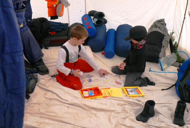
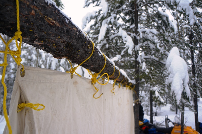
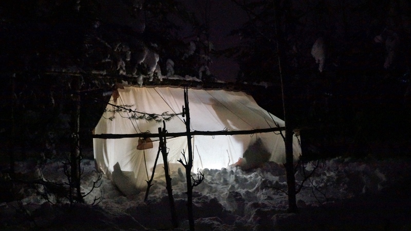
As a kid, I remember reading stories of prospectors and adventurers living in Canvas tents with tiny wood stoves to warm them. Over time that spirit of adventure was renewed, but due to their price tag (over $800 for the tent alone, not including the stove) those dreams had to remain dreams. That was until a friend of ours invited my son and I the opportunity to join on winter camping trip in Prince George, BC. The obvious and immediate response was “yes please!”, followed by, “when” and then, “What do we need to bring?”
Everything except the basics (clothes, lamps, snacks and sleeping gear) was provided, so we only needed to worry about packing our gear and making the long drive North.
Fortunately, there was a travel warning in effect, which meant that the roads would be clear. After a careful examination of weather radar, we made plans to miss the storm and have clear highways to ourselves. Blessed with great weather and a safe journey, we were set for the fresh foot and a half of snow and an excellent adventure.
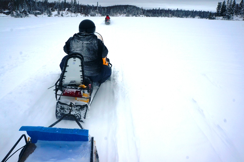
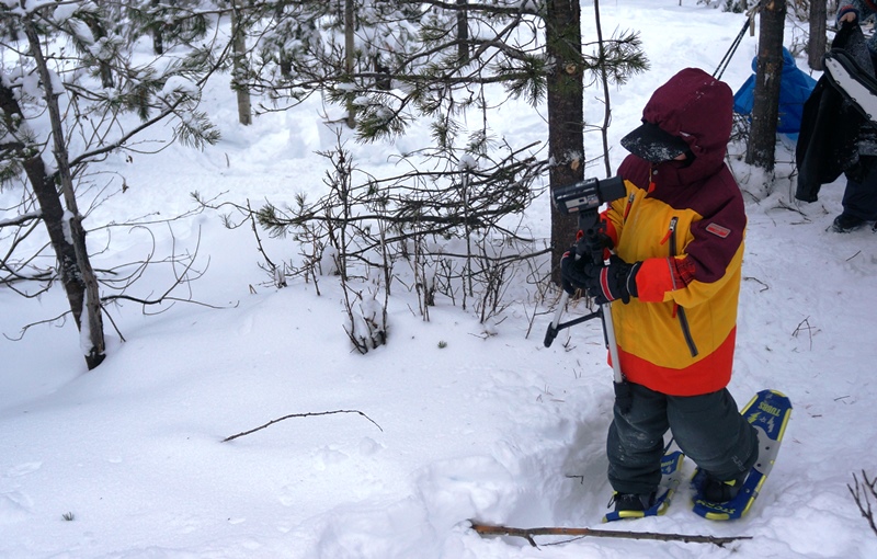
The plan was to travel by snow machine (call them sleds or “snowmobiles” if you want) up to an area that our guide, an experienced outdoorsman and author (Check out his books here) had scouted and prepped for us. We would set up a tent, put on a hot meal and go for a snowshoe. We were told to prepare for a cold night that would be followed by a hot breakfast and then a bit of ice fishing.
The kids were sat safely on the sled with an adult, but that left me to take up the fun position of riding the dog sled standing up as we crossed the lake and then navigated the spindly northern pines and spruces with their heavy laden boughs.
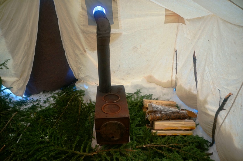
About twenty minutes later we arrived at our chosen site with cold faces and grins frozen on our cheeks. From there we set about preparing the poles for the canvas tent and collecting spruce boughs for the tent floor.
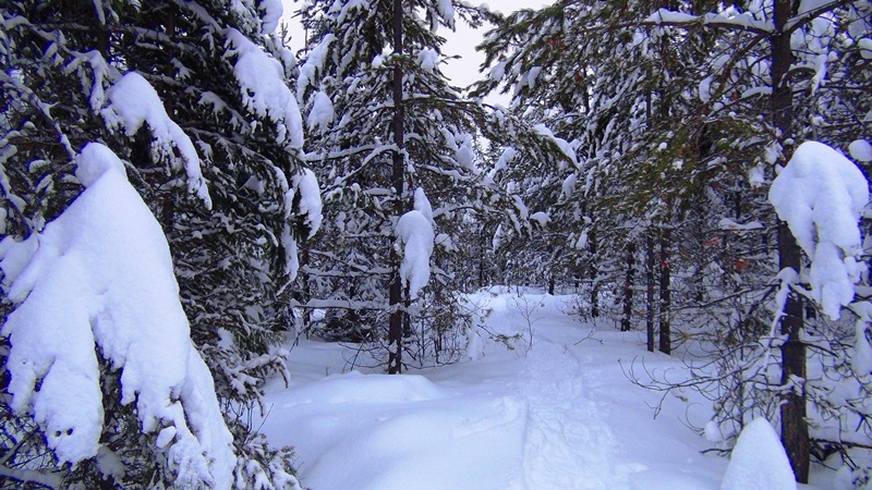
We warmed up in no time in the calm afternoon as we heaved the heavy canvas, constructed alder tripods and cleared the freshly fallen snow. The kids busied themselves making snow forts and exploring the deep snow for wildlife before they were wrangled into collecting firewood.
With the tent setup and the fire roaring we headed out for a snowshoe with the kids. Buoyed by the excitement of the experience, they ran about laughing and playing in the deep Northern snow.
Our Guide – Keith Billington
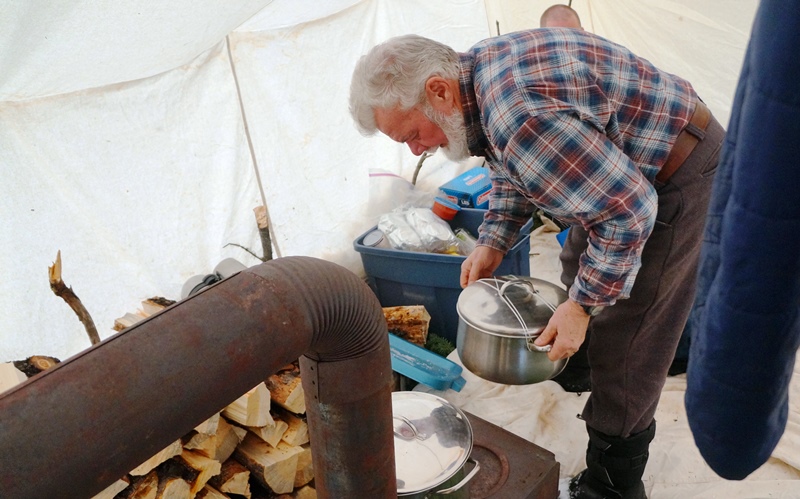
As we set up our sleeping arrangements for the night, the rich smell of stew mixed with the aroma of spruce bows worked with our hungry and tired bodies to whet our appetites. So, with full bellies we drifted off into sleep.
In a canvas “hot tent” the comfort and temperature of the shelter depends on the diligence of its occupants in feeding wood into the stove. We were told to prepare for cold in the early hours when the fire would typically die out, so we brought two sleeping bags each. We hadn’t anticipated the diligence of the other dad in our group who stoked the fire every time he sensed the cold. The result was a constant alternating between pulling the sleeping bags close to shut out the cold and tossing them away as we gasped for air in the oppressing heat. Our guide joked that if he heard another log being tossed on the fire he had considered tossing one right back at him.
Breakfast was a delicious and filling bowl of oatmeal. Normally I don’t eat the stuff, but we all know that food tastes better on the trail… so I went back for seconds.
The kids rushed out again to explore, while the adults chatted and packed up camp. We headed back through the woods and out to the lake as I clung on to the sled as we sped back through the now falling snow. I was already reminiscing about the constant smiling of my son during the adventure and I wondered if I should revisit the idea of having our own a canvas tent. Maybe there would be money in the budget if we just looked a bit harder for it.
I stepped off of the plane in El Calafate, Argentina, day pack and shoulder bags stuffed full and betraying my regret at not bringing my good pack down to South America. I was squeezing a trip down to Patagonia just before taking my leave of Argentina, where I had been living for the preceding 4 months. There, amongst the friendly and effusive meat-eating and fun-loving Argentinians, I had been learning Spanish and working with my church. A trip down to Patagonia would be a perfect place to try out my newly earned language skills, as well as enjoy some scenery unlike anything I had ever seen before.
You could immediately tell that El Calafate was one of those types of places, near the middle of nowhere and a rugged haven for nature enthusiasts and multi-day hikers. If you were to read a guidebook, it may tell you of the fierce wind that whips across these seemingly barren plains almost every day of the year, unencumbered by large shrub or tree to stop it. I had the good fortune not to experience the strong wind or below freezing temperatures for which the region is so famous.
Nearly everyone that lives in El Calafate either works in the tourism industry or lives with people who work in the tourism industry. I would be staying with a friend of a coworker of a friend, a typical traveller’s connection, and there was no surprise when I arrived in front of the cabin-like house to see that she was ready with suggestions, advice, the willingness to call the tourism companies to arrange for me a place with the activities that tended to fill up fast. The people here have a warmth and zest for life that contrasts with the glacial surroundings. Well, at least they do when talking in Spanish. Although there is much more of a culture of people who know how to speak English in large tourism areas like El Calafate and El Chaltén, it still would be a good idea for the non-Spanish speaker to come with a Spanish phrase book, or ideally with someone who at least knows a bit of Spanish.
El Calafate as a town is named for the berry ‘el calafate’, of which it is said that one is ensured to return if he or she should eat of it. Did I try it? Of course. Why would anyone not want to return to a place of larger-than-life mountains and larger-than-life people? I heard, while I was in down there, that Patagonia was the runner-up location for the filming of the ‘Lord of the Rings’ movies, and after being there I can completely believe it.
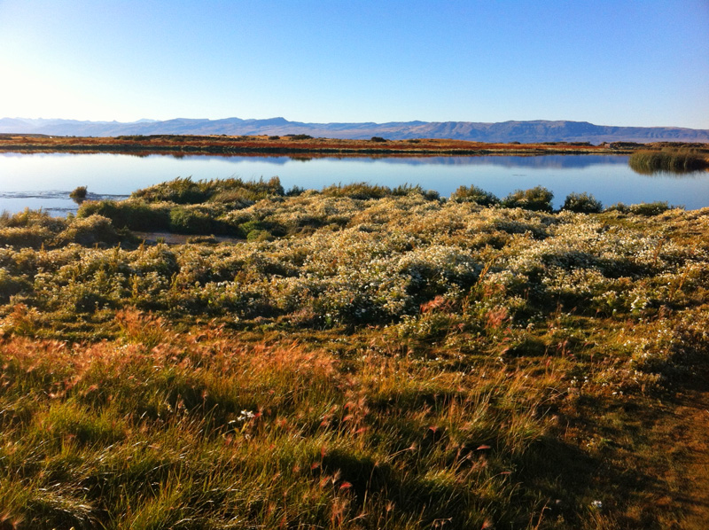
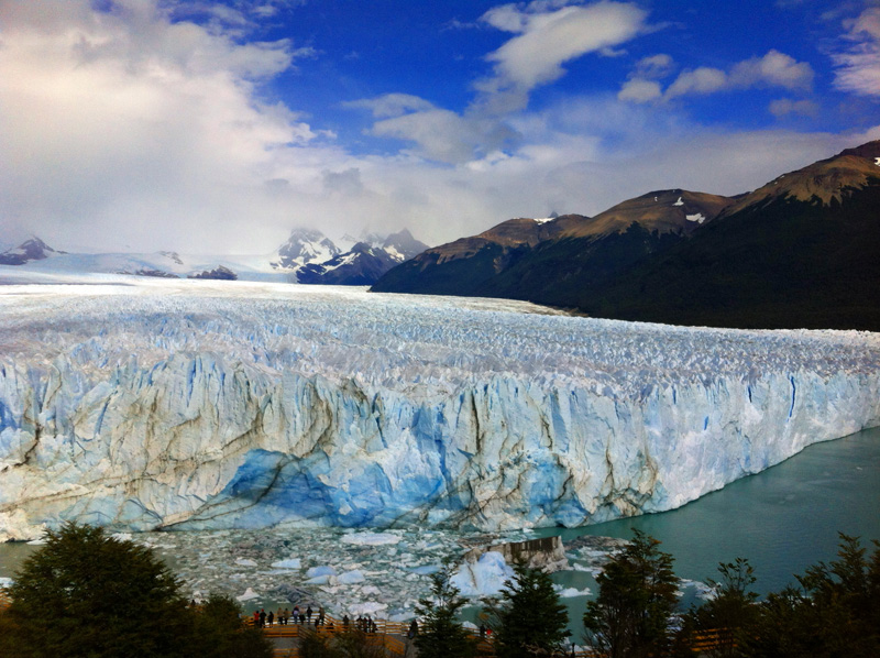
Anyway, back to my arrival. I had a couple days in El Calafate before I would head up to El Chaltén, the hiking capital of Argentina. Possible things to do included a boat tour on the lake to see icebergs, a tour to the nearby glacier Perito Moreno, hiking for 2 or 4 hours on the aforementioned glacier, a museum about this glacier, or staying at home and walking around the chintzy tourist stores downtown. I chose to go view the glacier from the boardwalk the next day and booked my ‘big ice’ experience, a 4 hour glacial hike, for the day after. That afternoon I walked up to the Laguna Nimez Reserve, a bird sanctuary with a short walking loop.
The next day, after a pleasant hour long bus ride where I met people from Australia, Israel, France, Germany, Argentina (of course), Canada and a few other European countries, we arrived at the boardwalk in front of the glacier. Perito Moreno is one of the only glaciers in the Patagonian ice fields that is growing. As such, it advances until it hits the opposite shore of Lago Argentina (Argentina lake), cutting off some of the water, which bores out a tunnel that will eventually fall with a resounding crash. While we didn’t get to see one of these tunnels, I was amazed at just how auditory an experience was visiting the face of the glacier, when sheets of ice 60 feet tall split, popped, and fell with a resounding crash, forming giant ice cubes that would float down the lake. Seeing the face of the glacier, with it’s variegated blue hues and it’s top that looked like a combination of whipped cream and snow roughly indented by tire treads, I was eager for the glacial walk that I would take the next day. However, that must be a story for another time. Hasta Pronto!
Colleen U.
The Outdoor Adventure Team
Colleen is a Physical Therapist, runner, all-round adventurer and world traveller
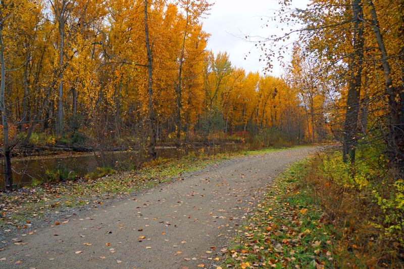
Here comes a Caravan The first Saturday of November we spontaneously decided to drive an hour to the Mission Creek in Kelowna, a trail wide and flat, as city trails often are.
It was wonderful to stretch our legs after a long week of school and work. Our six-year-old was so proud of himself for biking the 6 or so miles. The fall leaves were golden, the sky was silver, the river was a ribbon of blue, and we all felt like a million bucks. Unfortunately, since our wallets don’t feel the same way, to make this all happen, we had to plan ahead. There’s a few things that made this all work. The past couple years, we’ve waited for good deals so we could buy:
1. A good bike trailer for our 2 and 4 year olds. (A Thule Cougar 2)
2. Helmets for everyone
3. A bike rack that could fit 5 bikes. (also a Thule – The Apex 5)
4. Bikes for the 8 and 6 year olds.
As life would have it, we got the bikes second-hand, so we were able to splurge on the trailer and rack. We also picked up a free a tag-a-long bike for the 4-year old for when he’s ready. We picked up the ski/backpack kit with the Thule as well, which means that its life is extended into the winter months, making it a four-season investment.
As for picking our adventures, the Okanagan is full of them. We’ve been asking around at Vernon and Kelowna Tourism for ideas on kid-friendly local bike trails, and they’ve been a huge help. So when the opportunity came up (i.e. weather permitted), we were ready to grab some water bottles and snacks and jackets and GO! Check out a short video of the trip below and share some of your favourite local bike trails!
Meeting up with friends at night, on a trail that I had never been on, without a map and with only a marginal idea of what I’m looking for… What could possibly go wrong?
I’d just arrived in Washington from Bolivia (where I had lived at around 10000+ feet for a few years) and was eager to go hiking. I was training to hike the John Muir Trail later in the summer, so this would be a test of how easily I could chew up the miles. The rest of my buddies had headed up to the site the day before as I had literally just arrived back and was booked into a trade show for the morning.
The plan was to meet up with them on Saturday evening for the last night, before heading out on Sunday. It was a short trip, but I’d at least get a bit of time outdoors.
The huge benefit of living at altitude is that your body is adapted to functioning on very little oxygen. Once you get to sea level, you feel unstoppable, full of energy and ready to conquer Everest.Add to that my lightweight pack and you might get how I was able to literally skip up the trail (even jogging a few times).
I should probably mention that I hadn’t been on the trail before. All I knew was that my friends were hiking about 3 miles up the trail, which I figured would take me about an hour and a half.
So, at about an hour into my jog I started looking for a bright tent, or maybe some smoke that would indicate that I was getting close to my friends. Seeing none, and worrying about the setting sun, I improved my paced and leaned into my trekking poles.
Finally, about an hour and a half into my adventure I saw people. I waved, and they waved back! Unfortunately, they weren’t the group I was looking for. I went from campsite to campsite hoping… and expecting to find them. After stopping by and meeting everyone, from the friendly smokers (who were clearly taking advantage of changes to Washington state law), the young couples, the out of shape ultralight backpackers and the noisy Boy Scout troop, I realized that this wasn’t the campground I was looking for. The name wasn’t even right McCallister camp? I think I’m looking for Neve camp. Finally, I was informed that I was around 7 miles up the trail, having arrived there in less than two hours. My destination was 4 miles back down the trail.
By then, there was light enough to set up my tent, but not enough to hike back down the trail and find my crew. Resisting the urge to set up camp in the dark, I chose a quiet site overlooking a beautiful, snow fed river and settled in for a good night’s rest.
In the morning, after a nice, hot breakfast I packed up and hiked back down the trail, this time with eyes out for any indication of camping. Finally, 45 minutes back down the trail I saw a clearly marked “camp x” sign within an arm’s length of the trail I walked up the previous day. Not only that, on the ground my name had been drawn with an arrow indicating which way I should have gone.
You can’t help but feel a bit sheepish when you are supposed to be Mr Outdoor Adventure. Especially when you’ve been working on your excuse for why you didn’t show up for 45 minutes and the best you can come up with is, “I didn’t think 3 miles was a big enough challenge!”
As I sat down with my cup of tea, waiting for the crew to get up I thought over my rookie mistake and feeling rather embarrassed. I looked across at their tent and a smile formed on my face. My friends had gone to bed the night previous with the bear spray OUTSIDE of the tent, and an open bag of beef jerky INSIDE the vestibule… I shook my head and chuckled to myself, “I guess it could have been worse!”
What silly mistakes have you made on the trial, but were able to laugh about after later?
Check out more “Outdoor Mistakes” on the Sierra Trading Post’s blog here: Mistakes in the Outdoors.
Ok, it took us 16 days, but if you want to see that trip condensed down to just 5 and a half minutes then this is the post for you. Over the next few months I plan to put together a series of posts on preparing for the trail, so keep an eye out. If you have questions that you want answered, I’d be happy to help. Just post them below.
If you’re looking to hike the John Muir Trail, you should be sending in your John Muir Trail permit application ASAP.
A great book for planning is the following by Elisabeth Wenk:
 The Outdoor Adventure Giving you tips, tricks & recommendations to help make adventuring in the Outdoors fun, safe & exciting for you and your kids.